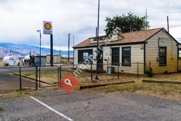


Lone Pine Airport is a public airport located one mile (1.6 km) southeast of Lone Pine (Geographic coordinates N36-35.30; W118-03.12) serving Inyo County, California, USA. The airport has two runways and is mostly used for general aviation. Charts: San Francisc; L5.UNICOM/CTAF Frequency: 122.8FacilitiesLone Pine Airport has two runways: Runway 16/34: 4,000 x 60 ft . Surface: Asphalt Runway 13/31: 2,400 x 100 ft . Surface: DirtWorld War IIDuring World War II, the airport was used as a contract flying school by the United States Army Air Forces. The contract flying school operated between 1942 and 1944. The school also controlled several auxiliary airfields: Adamson Landing Field Independence Auxiliary Field Inyo County Auxiliary Field
 Mammoth Yosemite Airport
83 miles
Missed my flight because I was only 45 minutes early to check in for flight that was ...
 Fresno Yosemite International Airport
93 miles
The airport is small, but it is very good for it's size. It has some places to eat in...
 Meadows Field Airport
97 miles
Horrible airport. I left my vehicle here for 4 days and my gas tank was completely si...
 Wasco-Kern County Airport
99 miles
 Tehachapi Muni Airport-TSP
103 miles
Easy to access airport. Normally windy. Nice lounge. Friendly staff
 General William J. Fox Airfield
128 miles
My family went to the airshow here and really enjoyed it all. One thing we really wo...
 Palmdale Regional Airport
135 miles
PMD is a joke of an airport the city of Palmdale should focus on bring up. Amazon for...
 Merced Regional Airport
144 miles
✈Boutique Air out of MacCready Regional Airport in Merced, California... You gotta LO...
 Pine Mountain Lake Airport
146 miles
Pine Mountain Lake Airport (E45) is a neat little airpark in the Sierra Foothills. Th...
Pine Mountain Lake Airport
146 miles
Pine Mountain Lake Airport (E45) is a neat little airpark in the Sierra Foothills. Th... Hesperia Airport
158 miles
Great place to have breakfast or lunch, very busy on weekends but very worth the wait...
 Columbia Airport
163 miles
One of the more popular Airports for pilots to fly into and have fun at the local sit...
 Bob Hope Airport
166 miles
I switched my flight from LAX to this one when I read reviews of how easy it is to ge...
 Van Nuys Airport
166 miles
Way smaller and easier to use than a large commercial airport such as LAX, this airpo...
Van Nuys Airport
166 miles
Way smaller and easier to use than a large commercial airport such as LAX, this airpo...to add Lone Pine Airport map to your website;
We use cookies and other tracking technologies to improve your browsing experience on our website, to show you personalized content and targeted ads, to analyze our website traffic, and to understand where our visitors are coming from. Privacy Policy