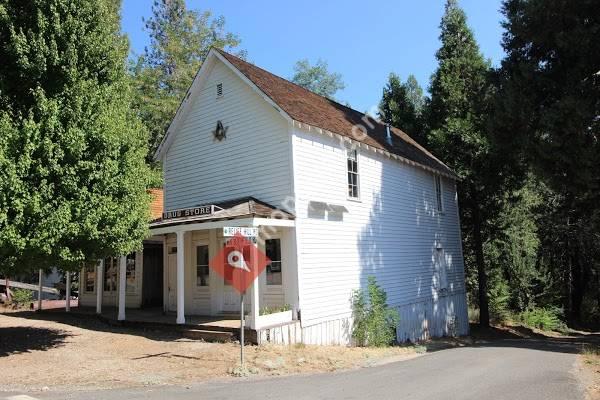


Malakoff Diggins State Historic Park is a state park unit preserving the largest hydraulic mining site in California, United States. The mine pit and several Gold Rush-era buildings were listed on the National Register of Historic Places as the Malakoff Diggins-North Bloomfield Historic District. The "canyon" is 7000ft long, as much as 3000ft wide, and nearly 600ft deep in places. Visitors can see huge cliffs carved by mighty streams of water, results of the mining technique of washing away entire mountains of gravel to wash out the gold. The park is a 26mi drive north-east of Nevada City, California, in the Gold Rush country. The 3143acre park was established in 1965.HistoryThe Malakoff mine pit on the San Juan Ridge is the impetus for one of the nation's first environmental protection measures. In 1850 there was little gold left in streams. Miners began to discover gold in old riverbeds and on mountainsides high above the streams. In 1851 three miners headed northeast of what is now Nevada City for a less crowded area to prospect. One miner went back to town with a pocket full of gold nuggets for supplies and was followed back by many prospectors. These followers, however, did not find any gold and declared the area "Humbug", thus the stream was so named "Humbug Creek". Around 1852, settlers began to arrive in the area and the town of "Humbug" sprang up. These miners could not decide how to move the dirt to a place where there was water.
 Scotts Flat Lake
6 miles
Love this place. The camping spaces are more than adequate and the staff are so nice ...
 Harmony Ridge Resort
7 miles
I have great memories here. It's been around for ages, my grandparents had a membersh...
 Pioneer Park
10 miles
Great place to relax for a walk or let the kids run off some energy, nice local/ hist...
 Nevada City Swimming Pool
10 miles
Perfect temperature, pleasant staff, affordable price, not too chlorinated. Great poo...
 Hirschman's Pond Public Land
11 miles
I went fishing there. There are largemouth bass in there. There might be trout but ...
 Hemenway Park
404 miles
Such a amazing park. We've been here with the kids several times to see the bighorn ...
 Cherokee Landing
1470 miles
We had the best time here. the atmosphere was great. The owner even helped me with pr...
 Shiloh on the Lake
1470 miles
We spent two nights here and had an amazing time! We spent the first night in a shelt...
Shiloh on the Lake
1470 miles
We spent two nights here and had an amazing time! We spent the first night in a shelt...to add Malakoff Diggins State Historic Park map to your website;
We use cookies and other tracking technologies to improve your browsing experience on our website, to show you personalized content and targeted ads, to analyze our website traffic, and to understand where our visitors are coming from. Privacy Policy